Geology of Nainital and History of Nainital

Prof Ajay S Rawat (nainilive.com)- The Seven Hills Nainital lake is surrounded by seven hills. On the left flank of the lake, while walking from Tallital to Mallital is the Ayarpatta Hill (2235 metres), Beyond Ayarpatta towards Aurbindo Ashram is Deopata (2273 metres).Adjacent to Deopata, near Barapatthar is Handi Bandi (2139 metres). Next to Handi Bandi is Cheena (2611 metres), the Alma (2270 metres), followed by Laria Kanta (2481 metres) and Sher-ka-Danda (2267 metres) up to almost Tallital.
The area around Nainital Lake is surrounded byb rocks of Krol formation, which are basically carbonaterocks around 570million years old. Their name is derived from the rock site around Solan in Himanchal Pradesh. Apart from rocks of Krol formation in Nainital, there are other types of rocks also.

The Nainital lake is flanked by two hills Ayarpatta and Sher-Ka-Danda. In Sher-Ka-Danda, there is mostly slate and marls, i.e. clay and lime. The Ayarpatta hill is made up mostly of dolomites (calcium and magnesium cardbonate formed owing to metamorphosis of limestone), sandstoneand slate. Deopatta hill there are red and purple shales, which are not very compact; they are very soft and can split easily into thin flat layers. Red and purple shales are also found in the Hanuman Garh Temple area. Towards Barapatthar side, on the Kaladhungi road, there are black shales with marls. Towards Kailakhand, on the Nainital Bhowali Road there is slate and limestone and in the golf course in Raj-Bhawan there is shale and grey lime stone.

Geologycally Nainital is very fragile, that can be easily destroyed or spoilt, as it is bounded by two thrusts. Theu are formed owing to folding of rocks due to upward force. Thrust is a high angle dislocationplane on the surface of the earth or below the below the surface. The main boundry Thurst (M.B.T.) forms the southern boundry and the Ramgarh Thrust forms the northern boundryof Nainital. There are several other faultsin Nainital like the Nainital Fault. Which separates Ayarpatta from Sher-Ka-Danda. It extends from the area between Deopatta and Nain Peak, and passes through Metropole hotel Naini Devi Temple, the bus station and along the Ballia Nullah and Ballia Ravine. The Ayarpatta Fault is parallel to the Nainital Fault and can be traced between St. Andrew and Emily Cottag.The Giwalikhet Fault extends from the North-East in Saulia Valley near Khurpatal to the Golf Course in Raj Bhawan. The continuous subsidence from the ravine west of Pines on the Bhawali road to the saddle between Sher-Ka-Danda and Lariya Kanta.
Lands slides in Nainital during the 19th Century.
While visualizing the advantages of Nainital as a tourist town, the British did not take into account the possibility of landsslides, which occurred in Nainital in August 1867, when part of the hill side above the west end of the main bazaar in Mallital come down. Fortunately there was no loss of life. The land slide had one adavantage; a committee for the first time was set up 6th August 1867 to consider the safety of the hill slopes. The committee, which submitted its report on 12th October 1867, regarded the drainage of the road as the most important aspect to be dealt with for preventionof landslides. Accourding to the report of the committee, “At that time very little provision had been made for surface drainage, and so after a long continued heavy rainfall of 20-32cm. on the night of Ist August Triggered the landslide.”

The Diabolic Landslide of 1880
After 1867, the next landslide occurred in Nainital, in the year 1880 near the Alma hill on the Sher-Ka-Danda ridge. This landslide occurred on 18th September 1880. The total number of people who died in the catastrophe was 151 of whom 43 were Europeans and the rest Indian. The main causes of the landslide were lack of drainage system, digging of fresh building sites on the ridge of hill together with the cutting of the hill side for gardens, roads and tennis courts and destruction of grassy cover the permitted the rain water to enter into the hill side The immediate cause of the landslide was a slight earthquake on the fatal day of 18th September, together with 50.8 cm. to 63.5 cm. of rain prior to the lands slide.

Ramsay Committee
After the land slide the Ransay Committee was formed on 22th September 1880. Its president was Sir Henry Ramsay, the then commissioner of Kumaon. The Ramsay Committee recommended the following measures:
i. Ravines to be lined and riveted.
ii. Fissures or long deep cracks to be filled with clay.
iii.Plateform, tennis courts and terraces to be covered with 15.24 cm. of rammed clay
iv. Further erection of buildings, quarrying and excavation of terraces or platform to be absolutely prohibited on the affected hill side. Special care should be taken to prevent injury from house drainage. All houses to have cove gutters and masonry drains leading to the nearest suitable ravine where provision should be made for its reception
v. Steep slopes to be turfed and planted with trees. No grass cutting or grazing to be allowed.
vi. An honest, efficient and trustworthy officer should be appointed as Inspector of Building and Drains who0 should work under the sole orders and responsibility of the civil officer in charge of the station.
A committee was further appointed in 1880 to consider the stability of hill slopes in and around Nainital on the request of the people to prevent a recurrence of the catastrophe of 1880.

About the Writer : Professor Ajay Singh Rawat is a judicious mix of an academic and an activist. He is internationally known in the field of Forest history and forestry, and was chairman of the International Union of Forestry research Organization, Vienna. Professor Rawat was the first Asian to reach this position hitherto. His books on Forest and History of Central himalayas have attained international acclaim.


नैनी लाइव (Naini Live) के साथ सोशल मीडिया में जुड़ कर नवीन ताज़ा समाचारों को प्राप्त करें। समाचार प्राप्त करने के लिए हमसे जुड़ें -

Naini Live is a news portal which provides news across Uttarakhand and Madhya Pradesh. We do provide advertisement services as well.
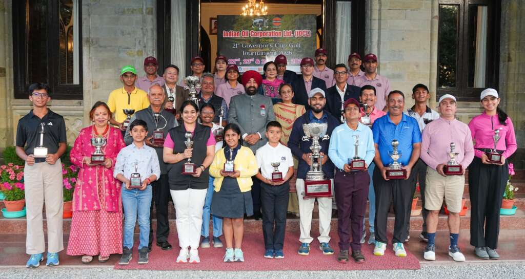 21वें गवर्नर्स कप गोल्फ टूर्नामेंट का हुआ समापन, समर्थ जैन रहे टूर्नामेंट के ओवरऑल चैंपियन
 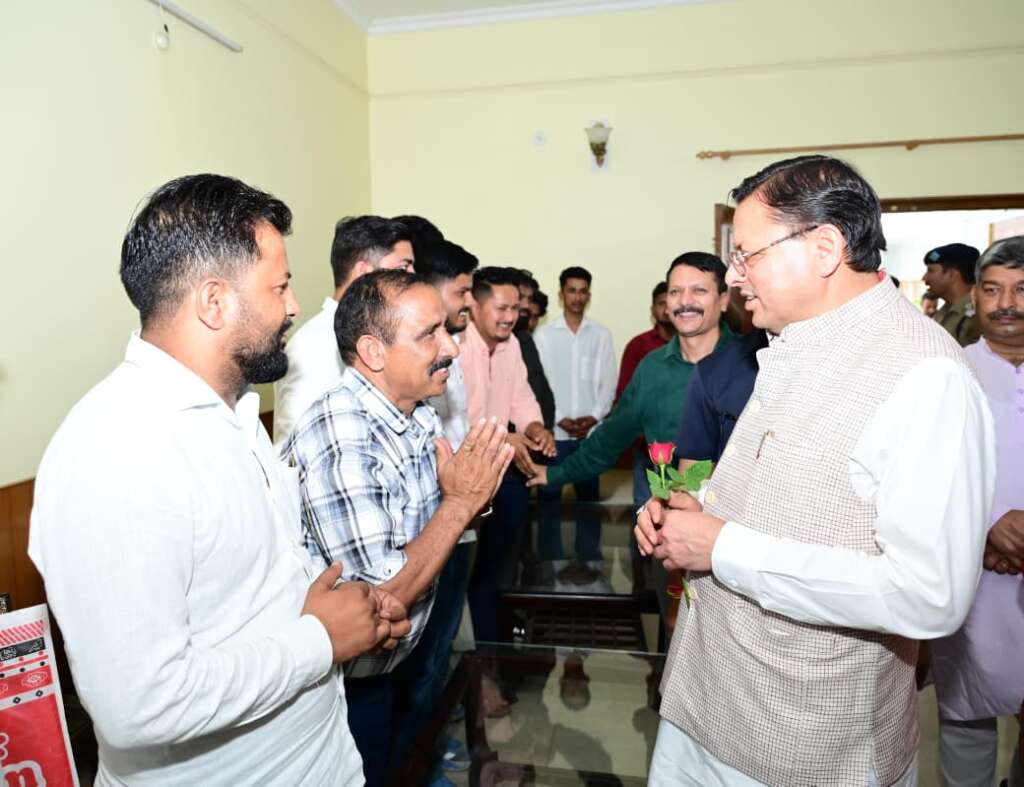 मुख्यमंत्री धामी ने काठगोदाम स्थित सर्किट हाउस में सुनीं आम जनता एवं स्थानीय जनप्रतिनिधियों से भेंट कर उनकी समस्याएं
 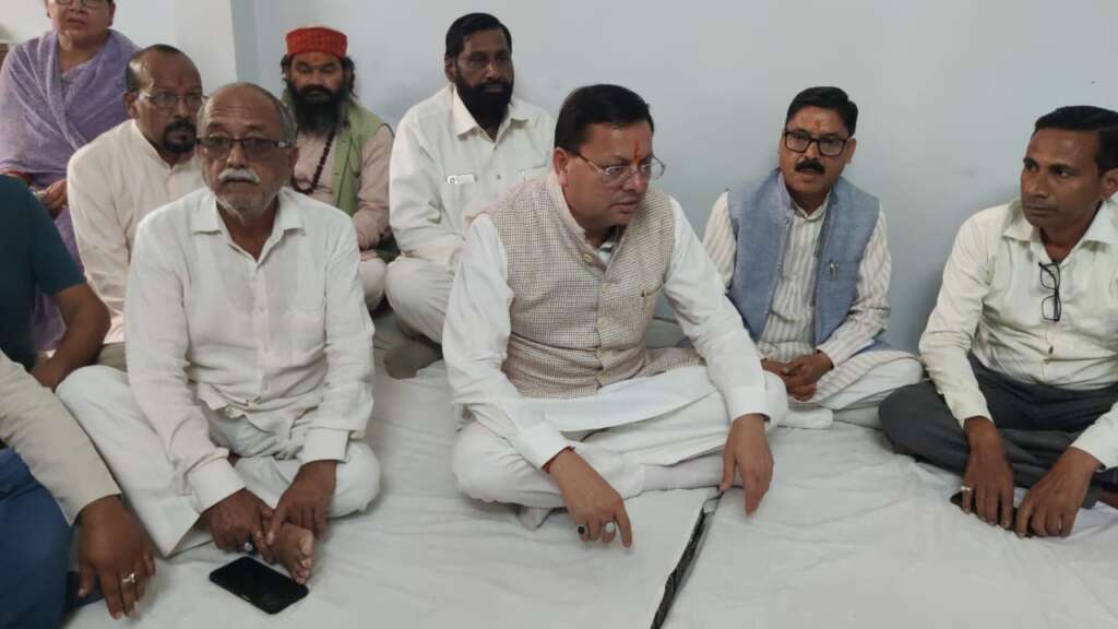 मुख्यमंत्री धामी ने विधायक रामनगर दीवान सिंह बिष्ट के आवास पहुंचकर उनकी धर्मपत्नी के निधन पर किया शोक व्यक्त
 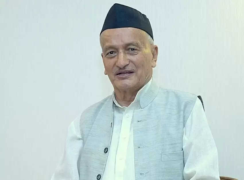 उत्तराखंड के पूर्व मुख्यमंत्री श्री भगत सिंह कोश्यारी को 25 मई को राष्ट्रपति द्रौपदी मुर्मु करेंगी पद्मभूषण से सम्मानित